[vc_row][vc_column width=”1/1″][heading]
Dolores River Canyon Wilderness: Rivers, Flumes and Hidden Petroglyphs
[/heading][/vc_column][/vc_row][vc_row][vc_column width=”2/3″][bar color=”Accent-Color” title=”Hike difficulty” percent=”20″][bar color=”Extra-Color-1″ title=”Photographic opportunities ” percent=”75″][bar color=”Extra-Color-2″ title=”Swimming opportunites” percent=”95″][bar color=”Accent-Color” title=”Condition of Petroglyphs” percent=”70″][bar color=”Extra-Color-3″ title=” Chance you will see other humans” percent=”3″][/vc_column][vc_column width=”1/3″][image_with_animation image_url=”3550″ alignment=”center” animation=”Fade In” img_link_large=”yes” img_link_target=”_self”][/vc_column][/vc_row][vc_row][vc_column width=”1/1″][vc_column_text]Rugged canyons, sage-green rivers, and an impressive collection of petroglyphs made this hike a brand new favorite.
We set out to poke around the old uranium mines in the Uravan area, but after a spontaneous decision to head to the Paradox Valley area, we found ourselves in the middle of one of the most pristine and private canyon settings I’ve ever explored.
I was born and raised in the desert so I get way too excited about water. It’s that whole feeling of not dying that really gets me going. This hike follows a RIVER the whole way. So even if you get stuck in some rocks and have to drink your own urine for several days, you might feel better knowing there will be water right there after you remove your mangled limb and limp back toward civilization.[/vc_column_text][/vc_column][/vc_row][vc_row][vc_column width=”1/1″][vc_column_text]
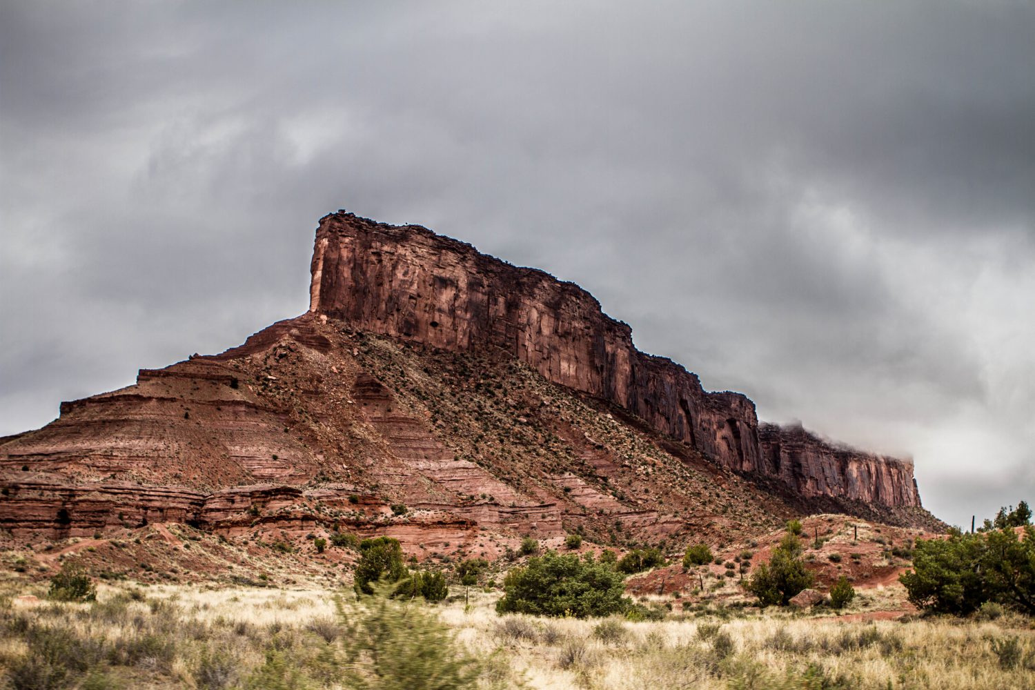
Getting there: Unaweep Canyon
This is one of my favorite places on earth. It’s 45 minutes from Grand Junction on the way to Gateway, and it holds stunning granite cliffs, bright green fields, and a nice winding highway. On this day, it was 33 degrees and snowing, but the bad weather made it look even more beautiful.
Take Highway 50 east to Whitewater and take a right to get on 141 to Gateway.[/vc_column_text][/vc_column][/vc_row][vc_row][vc_column width=”1/3″][image_with_animation image_url=”3551″ alignment=”center” animation=”Fade In” img_link_large=”yes” img_link_target=”_self”][/vc_column][vc_column width=”2/3″][image_with_animation image_url=”3552″ alignment=”center” animation=”Fade In” img_link_large=”yes” img_link_target=”_self”][/vc_column][/vc_row][vc_row][vc_column width=”1/1″][image_with_animation image_url=”3553″ alignment=”center” animation=”Fade In” img_link_large=”yes” img_link_target=”_self”][/vc_column][/vc_row][vc_row][vc_column width=”1/1″][vc_column_text]
Getting there: The Hanging Flume
20 miles south of Gateway on 141, look closely for the hanging flume.
This weird little structure was an open water chute built over the Dolores River Canyon. The Montrose Placer Mining Company built the flume in the 1880s to facilitate gold mining in the area. It’s pretty impressive structure, and a historical society recently made some repairs to the flume so you can better tell how it worked.
You can see it from the highway on one of the pullouts provided, but you’ll get a much better view from below by taking the Y11 road.
Exit at the “town” (just a few buildings) of Uravan on the right. Cross the bridge and take a right. About 1.5 miles down the road, you’ll see what’s left of the flume across the river. It looks like this:[/vc_column_text][/vc_column][/vc_row][vc_row][vc_column width=”2/3″][image_with_animation image_url=”3555″ alignment=”center” animation=”Fade In” img_link_large=”yes” img_link_target=”_self”][/vc_column][vc_column width=”1/3″][image_with_animation image_url=”3554″ alignment=”center” animation=”Fade In” img_link_large=”yes” img_link_target=”_self”][/vc_column][/vc_row][vc_row][vc_column width=”1/1″][vc_column_text]After you’ve snapped a few photos, keep following this road. You will pass the confluence of the San Miguel and Dolores Rivers and have a really pretty drive through a little canyon that works as a shortcut to Paradox Valley. When you get out of the canyon and into the valley, you’ll see this:[/vc_column_text][/vc_column][/vc_row][vc_row][vc_column width=”1/1″][image_with_animation animation=”Fade In” img_link_large=”yes” img_link_target=”_self” image_url=”3565″ alignment=”center”][/vc_column][/vc_row][vc_row][vc_column width=”1/1″][vc_column_text]Keep driving on that road until you come to highway 90. Take a right to head to the town of Bedrock. After the bridge, turn left on Y9 road. Follow it until you see the picnic tables around the boat launch and park your car in one of the open areas. Walk up the hill (following the road) and you’ll see this:[/vc_column_text][/vc_column][/vc_row][vc_row][vc_column width=”1/1″][image_with_animation alignment=”center” animation=”Fade In” img_link_large=”yes” img_link_target=”_self” image_url=”3556″][/vc_column][/vc_row][vc_row][vc_column width=”1/1″][vc_column_text]
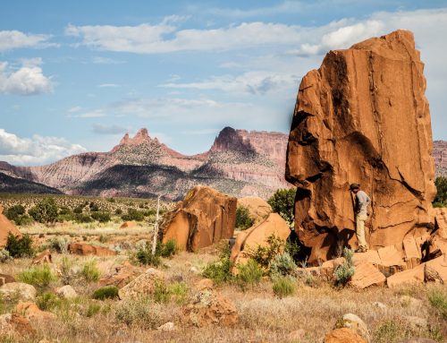
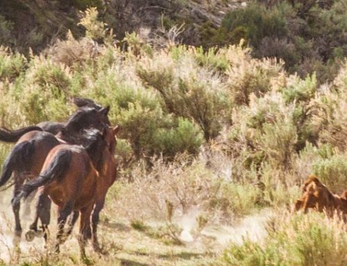
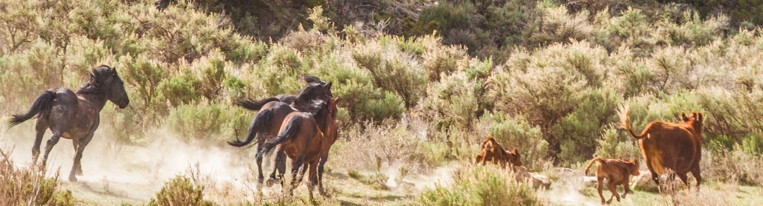
The old road-turned-trail follows the Dolores River for about 4 miles. It is a really stunning hike with lots of places for dogs/kids to swim. Be careful of the geese, though, they are crazy grumpy up in here.
[/vc_column_text][/vc_column][/vc_row][vc_row][vc_column width=”1/3″][image_with_animation image_url=”3563″ alignment=”center” animation=”Fade In” img_link_large=”yes” img_link_target=”_self”][/vc_column][vc_column width=”1/3″][image_with_animation image_url=”3562″ alignment=”center” animation=”Fade In” img_link_large=”yes” img_link_target=”_self”][/vc_column][vc_column width=”1/3″][image_with_animation image_url=”3561″ alignment=”center” animation=”Fade In” img_link_large=”yes” img_link_target=”_self”][/vc_column][/vc_row][vc_row][vc_column width=”1/4″][vc_column_text]
At about 3.5 miles in, try to spot the petroglyphs just off the trail on the right. We found about 4 different sets on different rocks. The bear claws are in excellent shape. Unfortunately, like just about every important archaeological site these days, people have defaced the art. In this case, though, some of them are old enough to be “historical” graffiti.
[/vc_column_text][/vc_column][vc_column width=”3/4″][image_with_animation image_url=”3560″ alignment=”center” animation=”Fade In” img_link_large=”yes” img_link_target=”_self”][/vc_column][/vc_row][vc_row][vc_column width=”1/1″][vc_column_text]The trail continues and in about a half mile, it turns right and seems to follow La Sal Creek. We stopped here and turned around, but I checked google earth later, and it looks like that old road goes all the way out to the highway. The canyon is small and deep and full of undergrowth, though, so if you plan to keep going, bring a machete![/vc_column_text][/vc_column][/vc_row][vc_row][vc_column width=”1/3″][image_with_animation image_url=”3559″ alignment=”center” animation=”Fade In” img_link_large=”yes” img_link_target=”_self”][/vc_column][vc_column width=”1/3″][image_with_animation image_url=”3557″ alignment=”center” animation=”Fade In” img_link_large=”yes” img_link_target=”_self”][/vc_column][vc_column width=”1/3″][image_with_animation image_url=”3558″ alignment=”center” animation=”Fade In” img_link_large=”yes” img_link_target=”_self”][/vc_column][/vc_row][vc_row][vc_column width=”1/1″][vc_column_text]If you have time, you can head back to Grand Junction via Moab. It is only a few minutes longer than the way you came in, and it’s just as pretty. At Bedrock take a left on the highway. Follow it until Highway 191 in Utah, and take a right towards Moab. This highway takes you to I70 west, and home.
This hike with dogs made us extremely dirty, but the good people at El Tapatio didn’t mind. Go for a lengua (friend cow tongue) street taco and a jumbo margarita.[/vc_column_text][/vc_column][/vc_row]

Leave A Comment